
Introduction
Dinosaur National Monument protects a landscape where deep time is visible in more than one way. The monument is famous for its quarry exhibit, where visitors can stand beside a wall of more than 1,500 dinosaur fossils still embedded in rock. Beyond the fossils, Dinosaur also preserves desert, mountains, river canyons, petroglyphs, homesteader cabins, wildlife habitat, and dark night skies. For more background, visit the Wikipedia page.
The monument spans parts of northeastern Utah and northwestern Colorado. Many first-time visitors focus on the Utah side near Jensen, Vernal, and the fossil quarry area, while the Colorado side opens into remote canyon country around Harpers Corner, Echo Park, and the Green and Yampa rivers.
Quarry Exhibit Hall
The Dinosaur Quarry Exhibit Hall is the classic first stop. A shuttle or seasonal access road connects the Quarry Visitor Center with the exhibit hall, where the exposed fossil wall includes bones from dinosaurs such as Allosaurus, Apatosaurus, Camarasaurus, Diplodocus, and Stegosaurus. It is one of the best places in the National Park System to see dinosaur fossils in place rather than mounted in a museum hall.
Split Mountain
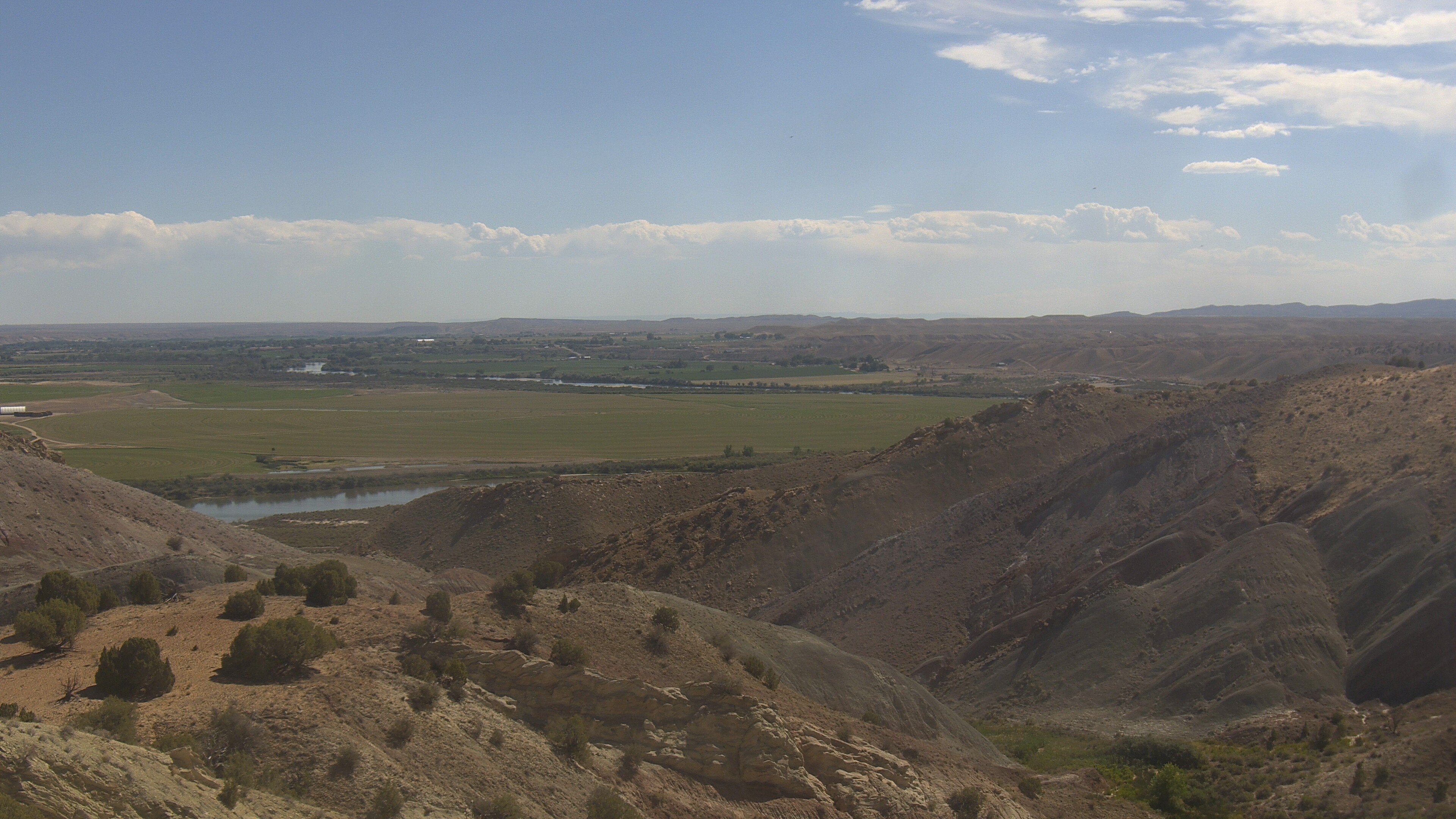
Split Mountain rises east of the Quarry area and is one of the monument's signature geologic landmarks. The Green River cuts through the mountain in Split Mountain Canyon, exposing tilted rock layers and showing how dramatically the landscape has folded, uplifted, and eroded. The Split Mountain webcam looks from the Quarry Exhibit Hall toward these highly eroded cliffs and ridges.
Top Hikes
These three hikes are good starting points for planning, with at least one more difficult option. Distances and elevation gain are rounded; check the official park trail page for current closures, permits, weather, and trail conditions.
Harpers Corner Trail (moderate) - 2.0 miles (3.2 km); elevation gain 300 feet (91 m). A rim walk to canyon views over the Green and Yampa river country.
Sound of Silence Trail (moderate) - 3.2 miles (5.1 km); elevation gain 400 feet (122 m). A desert route through colorful badlands and quiet geologic scenery.
Ruple Point Trail (difficult) - 9.2 miles (14.8 km); elevation gain 1,000 feet (305 m). A longer route to a remote overlook above the Green River.
River Rafting
The Green and Yampa rivers are the wild heart of Dinosaur National Monument. Multi-day rafting trips travel through deep canyons, quiet beaches, rapids, and remote campsites. If visitors have the time, river rafting is highly recommended because it shows a quieter, deeper side of the monument that is hard to appreciate from the roads alone. The Yampa is one of the last mostly free-flowing rivers in the Colorado River system, while the Green River cuts through Lodore Canyon, Whirlpool Canyon, and Split Mountain Gorge.
Private river trips require permits, and many visitors choose a commercial guide service. River conditions, permit seasons, campsite rules, and boating regulations change with water levels and season, so trip planning should start with the official NPS river information.
Petroglyphs and History
Long before the monument was established, Indigenous people lived, traveled, hunted, and created rock art in this region. Several petroglyph and pictograph sites can be viewed from short walks or roadside stops, especially along Cub Creek Road. Visitors should never touch, trace, chalk, or climb near rock art panels, because oils and abrasion can permanently damage them.
Camping
Dinosaur has six developed campgrounds spread across the Utah and Colorado sides of the monument. Green River Campground and Split Mountain Campground are closest to the Dinosaur Quarry area. Echo Park, Deerlodge Park, Gates of Lodore, and Rainbow Park offer more remote settings, though some access roads are unpaved and can become impassable when wet.
Some campground reservations, group sites, and permit information are available through Recreation.gov for Dinosaur National Monument. Backcountry camping is also possible with a free permit. Most of the monument is remote, and black bears live here, so food storage, route planning, and Leave No Trace practices matter.
Weather
Dinosaur is a high-desert monument with hot summers, cold winters, and large swings between sun and storm. Summer heat can be intense on exposed trails, while winter can bring snow, ice, and difficult road conditions, especially on unpaved roads. Spring and fall often offer the most comfortable hiking and sightseeing weather.