
Yoho National Park Webcams

View Yoho National Park webcams from Emerald Lake and Field, British Columbia, plus weather, maps, and official Parks Canada planning links.

Live Cams & Maps

The Yoho National Park webcams include Emerald Lake Lodge Webcam, Field - SE Webcam, and Field - NE Webcam from Emerald Lake Lodge and DriveBC. Check these views with the map and weather before you visit.

Park location
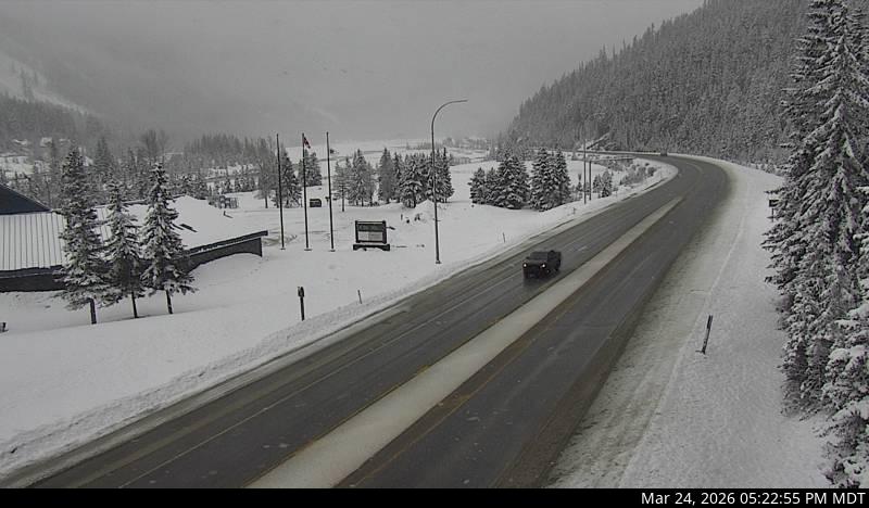
Current Emerald Lake Lodge webcam image from Yoho National Park.
Emerald Lake LodgeEmerald Lake Lodge Webcam

Current image

Current Emerald Lake Lodge webcam image from Yoho National Park.

Open live webcam
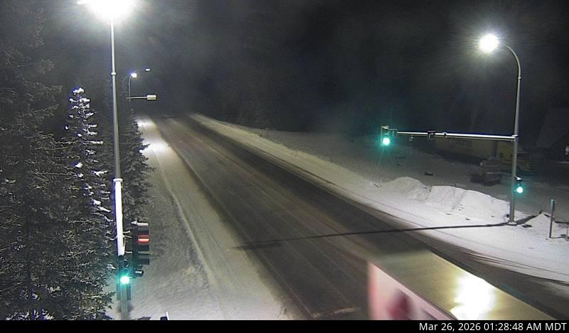
Field - SE Webcam: Highway 1 about 16 km west of the BC/Alberta border at Field Access Road, looking southeast. Images provided by Parks Canada through DriveBC.
DriveBCField - SE Webcam

Current image

Highway 1 about 16 km west of the BC/Alberta border at Field Access Road, looking southeast. Images provided by Parks Canada through DriveBC.

Open live webcam
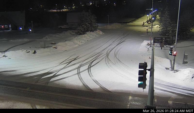
Field - NE Webcam: Highway 1 about 16 km west of the BC/Alberta border at Field Access Road, looking northeast. Images provided by Parks Canada through DriveBC.
DriveBCField - NE Webcam

Current image

Highway 1 about 16 km west of the BC/Alberta border at Field Access Road, looking northeast. Images provided by Parks Canada through DriveBC.

Open live webcam
Field - SW Webcam: Highway 1 about 16 km west of the BC/Alberta border at Field Access Road, looking southwest. Images provided by Parks Canada through DriveBC.
DriveBCField - SW Webcam

Current image

Highway 1 about 16 km west of the BC/Alberta border at Field Access Road, looking southwest. Images provided by Parks Canada through DriveBC.

Open live webcam

Current Conditions

Live alerts where available, air quality, and official road status links for Yoho National Park.

Alerts Official Updates

Open the official park site for current notices and closures.

Open official updates
Roads Official Status

Use the official park site for road closures, seasonal access, and local travel notices.

Open road conditions

Weather

Next 12 hours Local park time

Loading sunrise and sunset...
Loading hourly forecast...

7 day outlook

Loading forecast...

Introduction

Yoho National Park sits on the western slope of the Canadian Rockies in British Columbia, next to Banff National Park and Kootenay National Park. Parks Canada describes Yoho as a landscape of towering rock walls, waterfalls, lakes, fossils, and mountain passes. The park is part of the Canadian Rocky Mountain Parks UNESCO World Heritage Site.

For a broader overview of the park's history and geography, see the Yoho National Park Wikipedia page.

The park includes Field, Emerald Lake, Takakkaw Falls, Natural Bridge, the Kicking Horse River, Burgess Shale fossil sites, and access to Lake O'Hara by reservation. Visitors should check Parks Canada alerts, trail information, camping details, and road conditions before traveling because snow, wildlife activity, avalanche terrain, and seasonal road closures can affect plans.

Top Hikes

These three hikes are good starting points for planning, with at least one more difficult option. Distances and elevation gain are rounded; check the official park trail page for current closures, permits, weather, and trail conditions.

Emerald Lake Loop (easy) - 3.3 miles (5.3 km); elevation gain 115 feet (35 m). A scenic lake loop with forest, mountain, and wetland views.

Iceline Trail (difficult) - 12.4 miles (20.0 km); elevation gain 2,300 feet (701 m). A high-country route with glacier views above the Yoho Valley.

Lake O'Hara Alpine Circuit (difficult) - 7.0 miles (11.3 km); elevation gain 1,625 feet (495 m). A premier alpine route where access is limited and advance planning matters.

Emerald Lake

Emerald Lake is one of Yoho's signature destinations and the location of the Emerald Lake Lodge webcam. The area has lakeshore views, hiking, paddling in season, and winter scenery. The access road can be busy, so visitors should plan extra time during peak travel periods.

Lake O'Hara

Lake O'Hara is a highly protected alpine area in Yoho National Park. Access is limited, and visitors generally need Parks Canada reservations or approved arrangements for the bus, camping, day use, or lodging. Confirm the current Lake O'Hara access rules before planning around this area.

Camping

The Parks Canada camping page has current Yoho frontcountry camping information, including Kicking Horse, Monarch, Hoodoo Creek, and Takakkaw Falls. Use Parks Canada's camping information for current reservation details and operating dates. Yoho also has backcountry camping options, and Parks Canada lists rules and reservation details for those sites separately.

Scenic Areas

Yoho's best-known scenic stops include Emerald Lake, Natural Bridge, Takakkaw Falls, the Spiral Tunnels viewpoints, Wapta Falls, the Kicking Horse River corridor, and mountain viewpoints near Field. Seasonal closures are common, especially on roads and trails that reach higher elevations.

Webcam Notes

Feed credit: Emerald Lake Lodge and DriveBC.

Planning answers

Frequently Asked Questions

What is the best time of year to visit Yoho National Park?

The best time to visit Yoho National Park is July through September, when higher trails, lakes, waterfalls, and scenic drives are most accessible. Early summer can still have snow at elevation.

What does it cost to enter Yoho National Park, and do I need a pass or permit?

Yoho National Park requires a Parks Canada entry pass, available as a daily pass or Discovery Pass. Camping, backcountry permits, shuttles, and some attractions or guided activities cost extra.

Why might a Yoho National Park webcam be unavailable?

Park webcams can go offline because of weather, seasonal closures, maintenance, power issues, network outages, or camera provider changes.

Where can I confirm official Yoho National Park conditions?

Use this page as a quick webcam and planning hub, then confirm closures, alerts, road status, permits, and current conditions with the official Parks Canada page for Yoho National Park.