
Introduction
Jotunheimen National Park protects some of Norway's highest and most dramatic mountain country, including the Galdhopiggen, Glittertind, Gjende, and Hurrungane areas. The park is known for high peaks, glaciers, lakes, hut-to-hut routes, reindeer habitat, and classic Norwegian mountain trekking.
For broader background on the park's geography, protected status, and mountain landscape, see the Jotunheimen National Park Wikipedia page.
The official Jotunheimen National Park site describes the park and the Utladalen Protected Landscape as a place for high peaks, deep valleys, quiet mountain lakes, and strong nature experiences. Use the official park site, local weather, and route-specific sources before starting a hike.
Top Hikes
These three hikes are good starting points for planning, with at least one more difficult option. Distances and elevation gain are rounded; check the official park trail page for current closures, permits, weather, and trail conditions.
Besseggen Ridge (difficult) - 8.1 miles (13.0 km); elevation gain 4,265 feet (1,300 m). One of Norway's most famous ridge hikes between Memurubu and Gjendesheim, with steep, exposed terrain above Gjende and Bessvatnet.
Galdhopiggen from Juvasshytta (difficult) - 6.8 miles (11.0 km); elevation gain 2,100 feet (640 m). A guided glacier-crossing route to Norway's highest summit, requiring rope-team travel and proper mountain conditions.
Glittertind (difficult) - 13.0 miles (21.0 km); elevation gain 3,280 feet (1,000 m). A long high-mountain route to one of Norway's highest peaks, where snow, weather, and navigation can make the day serious.
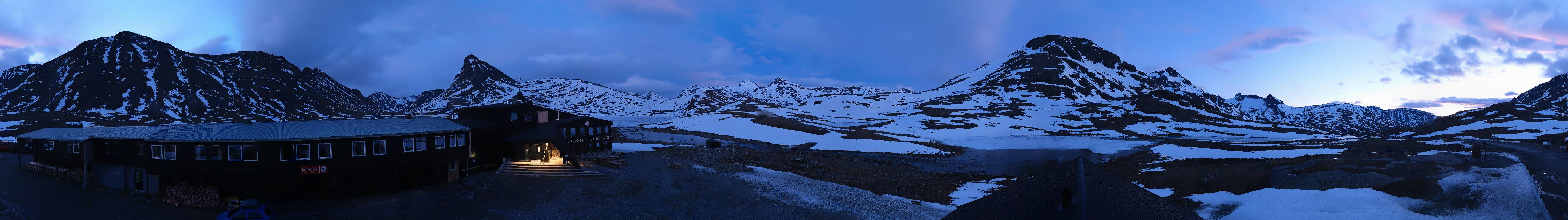
Mountain Webcams and Conditions
The webcam cards include a current Panomax image from Leirvassbu plus Windy webcam players for Spiterstulen and Eidsbugarden. Together they give useful high-country and lake-area views around Jotunheimen.
Nearby webcam directories such as DNT, meteoblue, Windy, and Outdooractive also list current images around Galdhopiggen Sommerskisenter, Spiterstulen, Leirvassbu, Krossbu, Sognefjellhytta, Gjendesheim, and Eidsbugarden. These are regional mountain-condition views rather than official national park cameras, so use them as weather, snow, cloud, road, and visibility context.
Safety, Access, and Huts
Jotunheimen has short hiking seasons, fast-changing weather, exposed ridges, snowfields, and glacier travel on some routes. Besseggen is steep and exposed in places, and Galdhopiggen from Juvasshytta typically requires a guided glacier crossing.
Plan around mountain huts, ferry schedules, marked routes, current weather, and daylight. Norway's right-to-roam tradition gives broad access, but visitors should camp responsibly, keep distance from buildings and huts, follow local restrictions, avoid damage to vegetation, and carry out all trash.