
Introduction
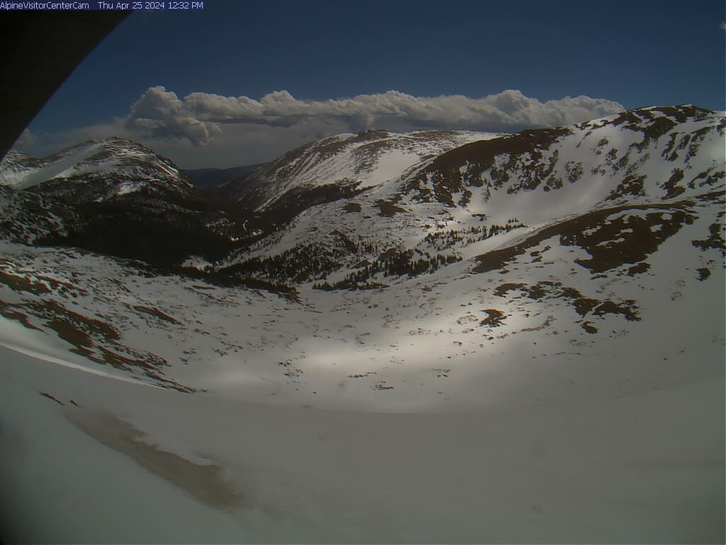
Rocky Mountain National Park is a spectacular mountainous region located in north-central Colorado, USA. Around 11,000 years ago, humans began venturing into the valleys and mountains of this area. The native Ute tribe favored the green valleys, tundra meadows, and crystal lakes. Although the Utes didn’t reside here year-round, they appreciated the natural beauty of the region. Spanish explorers and French fur trappers skirted the area during their wilderness forays. Major Stephen H. Long, after whom the peak is named, avoided these rugged barricades during his famous 1820 expedition. In 1843, Rufus Sage wrote the first account of Rocky’s wonders in a book called “Scenes in the Rocky Mountains.”. Word began to spread about the majestic landscape with its mountains and flowing streams.
The Pikes Peak gold rush of 1859 attracted miners and speculators to the region. Settlements like Lulu City (now part of the northwest part of the park) were established but proved temporary. In the 1860s, an industrious homesteading period began. Harsh winters made grazing difficult, but the abundant wildlife continued to draw Easterners.
By 1900, the national conservation and preservation movement gained momentum, led by figures like Theodore Roosevelt, Gifford Pinchot, and John Muir. The Estes Park Protective and Improvement Association advocated for local conservation efforts. Enos Mills, a naturalist, nature guide, and lodge owner, championed the creation of the nation’s tenth national park. He tirelessly lobbied Congress, hoping that future generations would find rest and hope in this pristine park. On January 26, 1915, President Woodrow Wilson signed the Rocky Mountain National Park Act, officially establishing the park.
Today, Rocky Mountain National Park covers an area of 415 square miles (1,070 square km), featuring glacier-carved valleys, alpine lakes, and plunging streams. The park is a UNESCO Biosphere Reserve. For more information, please go to the park's Wikipedia site.
Timed Entry
During the posted timed-entry season, visitors may need a Timed Entry Permit to enter Rocky Mountain National Park. Bear Lake Road Corridor access can require a separate permit option. Check the official NPS timed-entry page and Recreation.gov for current dates, permit windows, and exceptions before visiting.
Top Hikes
These three hikes are good starting points for planning, with at least one more difficult option. Distances and elevation gain are rounded; check the official park trail page for current closures, permits, weather, and trail conditions.
Emerald Lake Trail (moderate) - 3.6 miles (5.8 km); elevation gain 650 feet (198 m). A popular Bear Lake corridor route past Nymph, Dream, and Emerald lakes.
Sky Pond Trail (difficult) - 9.5 miles (15.3 km); elevation gain 1,780 feet (543 m). A demanding alpine lake hike via Glacier Gorge and Timberline Falls.
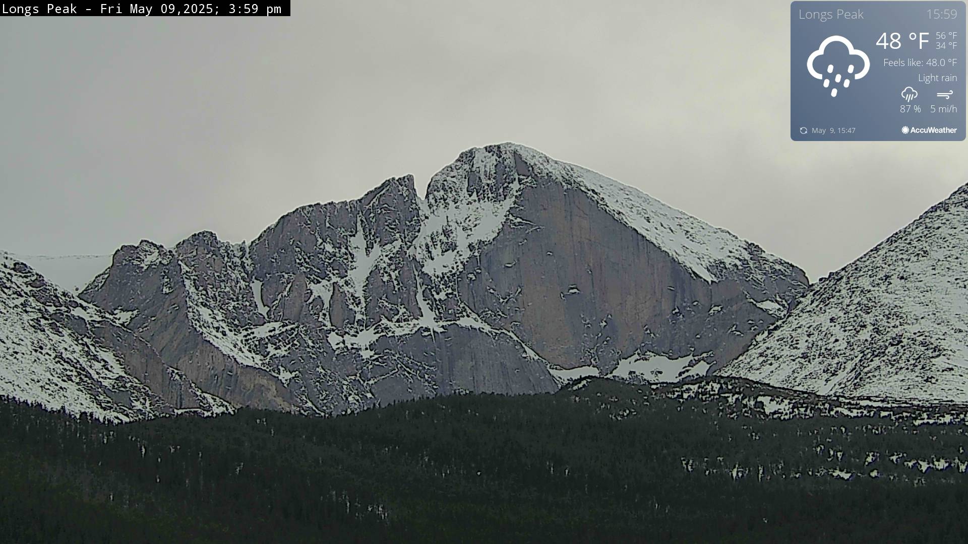
Chasm Lake Trail (difficult) - 8.4 miles (13.5 km); elevation gain 2,500 feet (762 m). A strenuous Longs Peak-area hike to a dramatic alpine lake.
Top Hikes
These three hikes are good starting points for planning, with at least one more difficult option. Distances and elevation gain are rounded; check the official park trail page for current closures, permits, weather, and trail conditions.
Emerald Lake Trail (moderate) - 3.6 miles (5.8 km); elevation gain 650 feet (198 m). A popular Bear Lake corridor route past Nymph, Dream, and Emerald lakes.
Sky Pond Trail (difficult) - 9.5 miles (15.3 km); elevation gain 1,780 feet (543 m). A demanding alpine lake hike via Glacier Gorge and Timberline Falls.
Chasm Lake Trail (difficult) - 8.4 miles (13.5 km); elevation gain 2,500 feet (762 m). A strenuous Longs Peak-area hike to a dramatic alpine lake.
Backpacking
Here are my three top backpacking hikes. Permits and bear-proof food canisters are required. Campfires are prohibited, and make sure to purify all water.
Bear Lake to Fern Lake Trailhead is 17 miles round trip with an elevation gain of 1,180 feet (360 m). The trailhead is located at Bear Lake Trailhead. This intermediate trek takes you through wooded alpine terrain, past meadows, and alongside lakes. Enjoy views of the beautiful mountains as you ascend gently. Camping spots are available along the route, making it perfect for a night out or an introduction to backpacking.
Timber Lake Trail is 9.3 miles round trip (15 km) with an elevation gain of 2,012 feet (613 m). The 4.5-mile hike to Timber Lake is perfect for a spur-of-the-moment night out. The trailhead is located at the Timber Lake trailhead. Wildlife is abundant and fishing is good.
East Inlet Trail is 10.3 miles (16.6 km) hike with an elevation gain of 1,794 feet (547 m). This trail takes you through a jaw-dropping valley, rolling over to two family-friendly destinations, the Adams Falls overlook and a spectacular valley viewpoint, before tucking into a pine-strewn forest and veering uphill. The trailhead is at Lone Pine Lake via East Inlet Trailhead. Lone Pine Lake sits above Grand Lake at over 9,500 feet, making it a serene destination along this trail.
Fishing
Sport fishing is a cherished pastime here, where the angler’s heart aligns with the rhythm of flowing rivers. Since the 1970s, the park has diligently worked to restore native cutthroat trout populations. Today, the parks host a diverse trout community, including brown, brook, rainbow, and cutthroat (both Colorado River and Yellowstone) trout, as well as the humble suckers and sculpin. However, many of the park’s high-altitude lakes remain pristine and devoid of fish due to their cold waters and limited spawning habitats.
Popular areas include the Big Thompson River, its waters winding through pine-clad valleys. Here, you can find rainbow and brown trout. On the northern part of the park, the Roaring River, a remote gem where elusive greenback cutthroats thrive. Popular lake fishing includes Mills Lake, Sky Pond, Emerald Lake and Dream Lake.
A Colorado fishing license is required if you are 16 or older. No other permit is needed, but heed the special regulations that safeguard these waters. Each angler can have a single hand-held rod or line. A "Second Rod Stamp" is not accepted within the park.
During the winter season, fishing is allowed in designated areas. Hand augers are permitted.
For all regulations and places to fish, go to the NPS website.
Camping / Lodging
There are five campgrounds within the park. Four are located on the east side and one on the west. Operating status and reservation windows can change by season and project work, so check the official NPS camping page and Recreation.gov before planning a stay.
East Side Campgrounds
Aspenglen Campground has 52 sites, with 13 dedicated to tents. There is no cell reception, showers, dump station or potable water. There are portable toilets during the summer.
Glacier Basin Campground has 150 sites, with 73 reserved for tents. There is no cell reception, showers or potable water. There are flush toilets and a dump station during the summer.
Longs Peak Campground has 26 tent only campsites. There is no cell reception, showers or potable water. There are vault toilets. The campground is at 9,500 feet (3,000 m) of elevation.
Moraine Park Campground is closed for a major rehabilitation project.
West Side Campground
Timber Creek Campground has 98 sites, with 30 reserved for tents. There is no cell reception. This campground is only open during the summer. A dump station, flush toilets and potable water are available at the campground.
Lodging
There are no lodges within the park. However, Estes Park and Granby offer many accommodations.