
Introduction
Teide National Park protects the high volcanic landscape at the center of Tenerife in Spain's Canary Islands. The park is centered on Mount Teide, Spain's highest mountain at 3,715 m / 12,188 ft, with Pico Viejo, lava flows, pumice fields, and the Las Canadas caldera forming one of Europe's most distinctive volcanic landscapes.
UNESCO lists Teide National Park as a World Heritage Site for its volcanic scenery and geological importance. The park is also one of Spain's busiest protected areas, so visitors should check current weather, trail status, road access, cable car conditions, and permit requirements before heading above the crater floor.
For broader background on the park's geography, geology, and protected status, see the Teide National Park Wikipedia page.
Top Hikes
Roques de Garcia Loop is one of the classic short walks in Teide National Park. Use the official PNT 03 Roques de Garcia route page for current route details; the trail circles the famous rock formations near the Parador with open views of Teide. Plan on roughly 3.5 to 4.5 km / 2.2 to 2.8 mi with about 175 to 200 m / 575 to 655 ft of elevation gain depending on the exact start and variant.
Siete Canadas Trail is a longer walk across the caldera landscape. Use the official PNT 04 Siete Canadas route page for current route details. It is a good choice for seeing the park's open volcanic plains, old lava forms, and changing views below Teide without committing to the summit. Plan on roughly 16 to 17 km / 10 to 10.5 mi one way with about 300 m / 985 ft of cumulative elevation gain.
Montana Blanca, La Rambleta, and Telesforo Bravo is the difficult Teide summit route when combined as a full climb. Use PNT 07 Montana Blanca - La Rambleta for the long climb and PNT 10 Telesforo Bravo for the final summit trail. Expect roughly 9 km / 5.6 mi one way from Montana Blanca to the summit with about 1,350 m / 4,430 ft of elevation gain. A permit is required for the final summit section, and current trail, cable car, weather, and equipment requirements should be checked before starting.
Cable Car, Trails, and Conditions
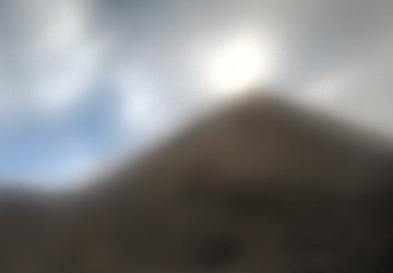
Teide's high elevation makes conditions very different from the coast. The Volcano Teide "Teide Today" page is useful for checking webcam images, upper-station weather, cable car status, trail status, and access-road status before a visit.
The cable car lower station is at about 2,356 m / 7,730 ft, and the upper station reaches about 3,555 m / 11,663 ft. The upper station gives access to short high-elevation routes, but the final Telesforo Bravo trail to the summit requires a permit and can close because of weather, ice, wind, or conservation controls.
Permits and Visitor Planning
Tenerife ON is the key planning source for regulated Teide trail permits and route details. Check the trail page for the route you plan to use, confirm whether a permit is required, and review mandatory equipment rules before you go.
Roads through Teide National Park can be affected by wind, snow, ice, wildfire risk, or high visitor volume. Use the official park page, Teide Today status, and Tenerife ON before committing to a long drive into the park.
Webcam Notes
Feed credit: Volcano Teide.