


Introduction
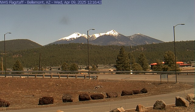
The Grand Canyon National Park, located in northwestern Arizona, is a world-renowned site that has captivated visitors for centuries. Its vast vistas, stunning colors, and remarkable geology make it much more than just a massive chasm in the Earth's crust. The Grand Canyon's geological story spans millions of years. Scientists estimate that the canyon began to form around 5 to 6 million years ago when the Colorado River began carving through layers of rock. Humans have inhabited the area for thousands of years, withevidence of Native American settlements dating back to the last Ice Age.
In 1919, President Woodrow Wilson designated the Grand Canyon as a national park, ensuring its protection and preservation. The United Nations later declared it a World Heritage Site in 1979. Today, the park covers an impressive 1,218,375 acres, equivalent to approximately 1,904 square miles (4,931 square kilometers).
The Colorado River winds through the canyon for 278 river miles (447 kilometers). At its narrowest point (Marble Canyon), the canyon spans 600 feet (180 m). The average rim-to-rim width is 10 miles (16 km), while the maximum rim-to-rim distance reaches 18 miles (28.8 km). The average depth is 1 mile (1.6 km), and the South Rim stands at 7,000 feet (2,100 m), while the North Rim reaches 8,000 feet (2,400 m) above sea level.
In 1540, Spanish soldiers led by García López de Cárdenas became the first Europeans to lay eyes on the Grand Canyon. They were part of Francisco Vázquez de Coronado's expedition, which aimed to find the legendary Seven Cities of Cíbola. After a six-month journey, Coronado's army reached the Hopi Mesas, east of the Grand Canyon. Guided by the Hopi, Cárdenas led a small party to discover a reported "great river." Cárdenas ordered three infantrymen to descend about 1,500 feet toward the river. They realized the river was wider than expected and not navigable for ships. Due to this response, further western exploration was dismissed, and the Grand Canyon remained unexplored for 235 years. Joseph Christmas Ives, a U.S. Army First Lieutenant and botanist, embarked on an expedition funded by the federal government. His mission was to explore the Colorado River and assess its usefulness as a trade route. Ives navigated up the river using a fifty-foot-long sternwheel steamboat called the Explorer. Although he crashed just below Black Canyon (not yet within the Grand Canyon itself), he continued upriver for another thirty miles in a skiff. Ives became the first European American known to reach the river within the Grand Canyon, shedding light on this mysterious landscape. For more information, visit the park's Wikipedia page. For a great book on the river and rafting the river, I highly recommend "The Emerald Mile."
Top Hikes
These three hikes are good starting points for planning, with at least one more difficult option. Distances and elevation gain are rounded; check the official park trail page for current closures, permits, weather, and trail conditions.
South Kaibab Trail to Cedar Ridge (moderate to difficult) - 3.0 miles (4.8 km); elevation gain 1,140 feet (347 m). A popular below-rim hike with open canyon views and a strenuous climb back out.
Bright Angel Trail to Havasupai Gardens (difficult) - 9.0 miles (14.5 km); elevation gain 3,060 feet (933 m). A long corridor-trail hike that demands early starts, water planning, and heat awareness.
Rim Trail (easy to moderate) - 13.0 miles (20.9 km); elevation gain 200 feet (61 m). A flexible rim route with shuttle access and repeated canyon viewpoints.
Campgrounds
There are several campgrounds in and near Grand Canyon National Park, but North Rim camping is affected by the Dragon Bravo Fire recovery. South Rim campgrounds continue to be the most reliable in-park options. Before planning any North Rim camping, check the North Rim status page for current openings, water availability, fire restrictions, and reservation updates.
South Rim Year-Round
Mather Campground is a popular camping facility and offers 327 campsites for tents, trailers, and RVs. It has amenities such as flush toilets, drinking water, camp store, laundry, and dump station. The campground is open year-round and reservations are recommended during peak season (March - November). Mather Campground is close to many attractions and activities in Grand Canyon Village, such as scenic overlooks, hiking (including Bright Angel), biking trails, visitor center, and shuttle bus system.
Trailer Village RV Park is the only RV campground in the park that offers full hookups (sewage, water, and electrical with 30 amp and 50 amp sites available). The park is open year-round and features paved pull-through sites that can accommodate vehicles up to 50 feet long. The campground is operated by Delaware North. The campground has 123 sites in total, out of which 80 sites have electric hookups and 43 sites do not have any hookups. The park has several amenities such as cell phone reception, trash/recycling collection, camp store, ice for sale, staff on site, laundry, dump station, and potable water.
South Rim Seasonal
Desert View Campground is situated at an altitude of 7,463 feet (2,274 m) and is located 23 miles (37 km) to the east of Grand Canyon Village. The campground has 49 campsites that are available by reservation only. The maximum length for RVs or vehicles pulling travel trailers is 30 feet (9 m). The campground offers spectacular scenery, less crowds, and amazing photography opportunities, especially at sunrise when first light paints the canyon in soft pastels. There are no electric hookups or RV-only sites available at the campground. However, the campground has several amenities such as picnic tables, fire pits, flush toilets, and potable water. The campground is open from mid-April to mid-October.
Ten-X Campground is located 9.5 miles (15 km) from Grand Canyon Village. The campground has 142 single campsites, each accommodating up to eight people maximum. The campground is located at 6,600 feet (6,600) of elevation. It is situated in a pleasant Ponderosa pine and Gambel oak forest There are also 18 double campsites that can accommodate up to 14 people. Thirty of these sites are non-reservable and only available on a first-come, first-served basis. All other sites are reservable. Sites include picnic tables, fire pits and grills, and vehicle parking, with access to nearby pit toilets. Group sites are available.
North Rim - Limited 2026 Reopening
The North Rim Campground is situated at an altitude of 7,800 feet (2,400 meters), but it is not operating on a normal schedule during Dragon Bravo Fire recovery. NPS says the campground is expected to reopen for tent and RV camping when conditions allow, with reservations released on recreation.gov after an opening date is established. Water and RV hookups will not be available, so campers should bring all potable water. Stage 2 fire restrictions are in effect for the 2026 season because of limited water resources.
DeMotte Campground is outside the park in Kaibab National Forest, north of the North Rim entrance. It can be an alternative when the forest campground is open, but visitors should confirm current reservations, fire restrictions, water availability, and road conditions before relying on it.
Lodges and Hotels
Most in-park lodging is currently on the South Rim. The historic Grand Canyon Lodge area on the North Rim is closed until further notice because of damage from the Dragon Bravo Fire. Check the North Rim status page before planning any North Rim travel.
South Rim
The Bright Angel Lodge is a historic lodge designed by architect Mary E.J. Colter in 1935 and has a natural rustic character. The lodge is a Registered National Historic Landmark and is rich with cultural history. Over the years, it has gone through many transformations - originally a hotel, then a camp, and finally a lodge. The lodge has 90 lodging units ranging from cozy historic units with shared bathrooms to standard lodge rooms and historic cabins to the one of a kind “Buckey O’Neill Cabin”, originally home of the Rough Riders. Accommodations range from rustic cabins (with satellite TV and private bath) to lodge rooms (all with no television and some with a shared bath). The Bright Angel Lodge is located at the top of Bright Angel Trail Head.
El Tovar is a celebrated historic hotel located directly on the rim, first opened in 1905. The hotel was designed by Charle Whittlesey, Chief Architect for the Atchison, Topeka and Santa Fe Railroad. It cost $250,000 to build, and it was considered it the most elegant hotel west of the Mississippi River. In 1987 the Hotel was designated a National Historic Landmark. El Tovar has 78 rooms, many of which are suites. Due to the historic nature of the hotel, no two rooms are alike, giving the hotel distinctive charm. There are 12 hotel suites.
The Kachina Lodge is a contemporary lodging option located at the South Rim. It was built in the late 1960s and sits directly on the canyon rim next to El Tovar Hotel. The guest rooms have a comfortable modern ambiance. Many guests choose Kachina due to its prominent location in the center of the historic district. Kachina Lodge is also walking distance to restaurants, gifts shops, Kolb Studio, Verkamp’s Visitor Center, and Bright Angel Trail Head. The facility is open year-round and the front desk is open 24 hours.
Thunderbird Lodge is a contemporary lodging option located at the South Rim, next to the Kachina Lodge. Many guests choose Kachina due to its prominent location in the center of the historic district. Kachina Lodge is also walking distance to restaurants, gifts shops, Kolb Studio, Verkamp’s Visitor Center, and Bright Angel Trail Head. The facility is open year-round and the front desk is open 24 hours.
The Maswick is located in Grand Canyon village and.25 mile inland from the historic district. Originally built in 1927 by Fred Harvey Company and the Santa Fe Railroad. The lodge has 280 rooms. Maswick is named for a Hopi Kachina who guards the canyon.
Yavapai Lodge is also locate on the South Rim of the park. It is a fairly large hotel and not on the canyon rim. Reservations can be made at the Delaware North Company.
North Rim
The North Rim developed area, including the Grand Canyon Lodge area, is closed until further notice because of impacts from the Dragon Bravo Fire. The fire burned through the historic lodge and surrounding cabin district, and visitors should check the NPS North Rim status page for current access, closures, and recovery updates before planning a trip.
The Grand Canyon Lodge was designed by architect Gilbert Stanley Underwood in 1927. The lodge was a Registered National Historic Landmark with guest rooms available by reservation only. The guest rooms had a comfortable rustic ambiance and were similar in size and amenities. The lodge was situated at an altitude of 8,200 feet (2,500 meters) and offered breathtaking views of the canyon.
Restaurants
There are several restaurants located on the South Rim of the Grand Canyon National Park. Here are some of the most popular ones:
El Tovar Dining Room: This is a classic national park dining restaurant that offers both international and local Southwest influences. It is located at the El Tovar Hotel and is open for breakfast, lunch, and dinner.
Yavapai Tavern: This is a great place to enjoy a drink and a meal after a long day of exploring the park. The tavern offers a variety of food options and has both indoor and outdoor seating.
Big E Steakhouse & Saloon: This is the premier steakhouse in the Grand Canyon and offers a variety of food options including steaks, seafood, and vegetarian dishes. They also have a video wall and a pet-friendly patio.
Arizona Room: This restaurant is located at the Bright Angel Lodge and offers a variety of American and Southwestern dishes. They are open for breakfast, lunch, and dinner.
Bright Angel Restaurant, Fountain & Bar: This restaurant is located at the Bright Angel Lodge and offers a variety of American dishes. They are open for breakfast, lunch, and dinner.
Harvey House Cafe: This restaurant is located at the Bright Angel Lodge and offers a variety of American dishes. They are open for breakfast, lunch, and dinner.
North Rim
North Rim lodge dining is closed until further notice because of Dragon Bravo Fire damage in the Grand Canyon Lodge area. Check the official North Rim status page before planning any North Rim visit.
Grand Canyon Lodge Dining Room: This restaurant was located at the Grand Canyon Lodge and offered a variety of food options including breakfast, lunch, and dinner.
Deli in the Pines: This restaurant was located at the Grand Canyon Lodge and offered a variety of food options including sandwiches, salads, and other quick bites.
Roughrider Saloon: This was a place to enjoy a drink and a meal after a long day of exploring the park. The saloon offered a variety of food options and had both indoor and outdoor seating.
Coffee Saloon: This restaurant was located at the Grand Canyon Lodge and offered a variety of coffee drinks, pastries, and snacks.
Bottom of Canyon: Phantom Ranch is our favorite. After a long hike, this is the perfect place to grab a cold drink and something and a snack.
Groceries
Grocery stores are limited within the park. On the south rim there is Canyon Village Market & Deli and the Canyon Village Market & Deli on the north rim.