
Introduction
Karkonosze National Park protects the highest part of the Sudetes on Poland's border with the Czech Republic, including Sniezka, glacial cirques, waterfalls, subalpine meadows, peat bogs, spruce forest, and exposed high ridges. The park is paired ecologically with Krkonose National Park on the Czech side.
For broader background on the park, see the Karkonosze National Park Wikipedia page. For current visitor rules, education, tickets, and official planning information, use the Karkonosze National Park official site.
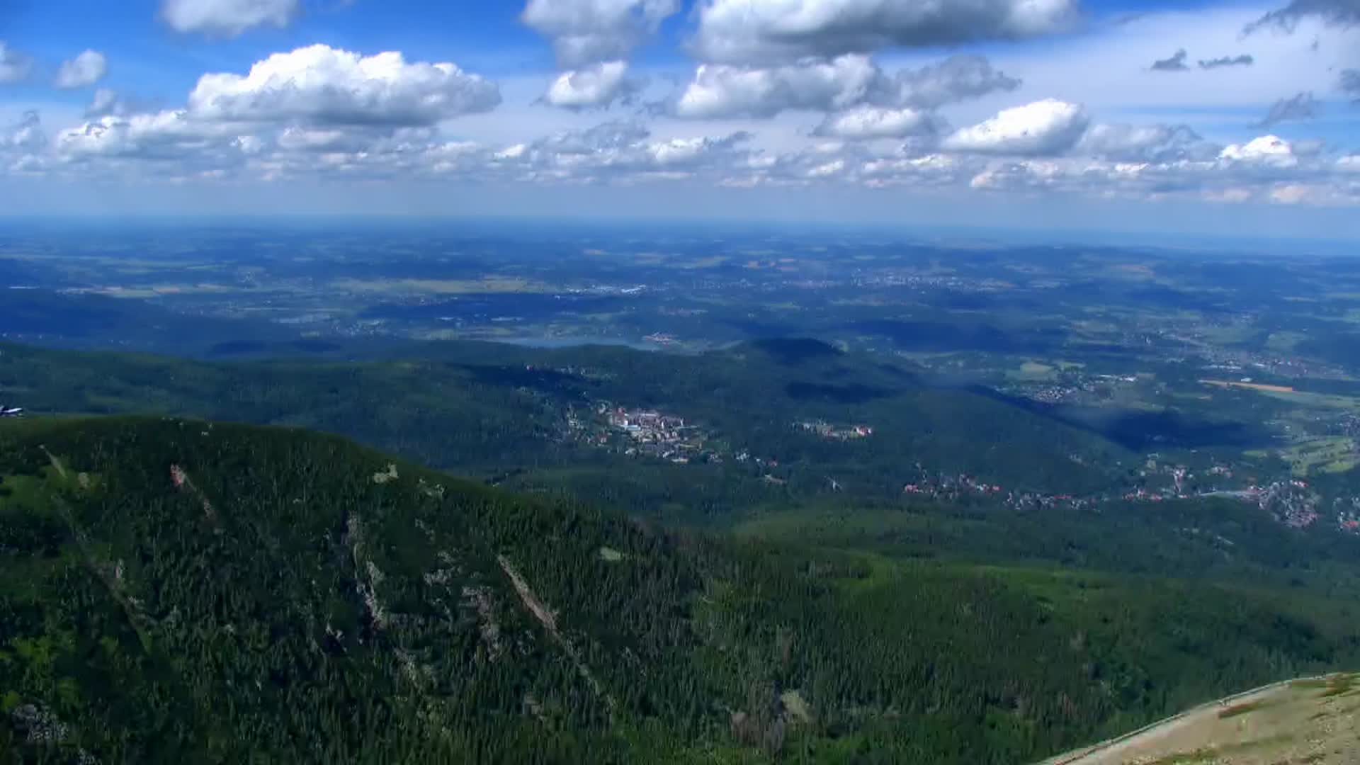
The webcam card on this page uses a current Sniezka image from WebCamera.pl. It is helpful for checking cloud, visibility, wind-exposed summit weather, snow, and general conditions around the highest part of the park.
Top Hikes
Sniezka from Karpacz is the classic high-point hike. A common route via the Wang Church area and mountain shelters is roughly 14 to 16 km / 8.7 to 10 mi round trip with about 800 to 900 m / 2,625 to 2,950 ft of elevation gain, depending on the exact path and descent.
Samotnia and Mały Staw are among the most scenic Karkonosze walks, linking forest, cirque-lake views, mountain shelters, and high-country scenery. From Karpacz, a loop can be roughly 12 to 14 km / 7.5 to 8.7 mi with about 500 to 700 m / 1,640 to 2,300 ft of gain.
Snowy Pits and Szrenica make a more difficult west-side ridge outing from the Szklarska Poreba area. Depending on route and transport choices, plan roughly 16 to 22 km / 10 to 13.7 mi with about 800 to 1,100 m / 2,625 to 3,610 ft of elevation gain.
Camping and Lodging
Most visitors stay in Karpacz, Szklarska Poreba, Jelenia Gora, or nearby villages. Mountain shelters, hotels, guesthouses, apartments, restaurants, and ski-area services are common around the park edges, while camping and overnight use inside protected areas follow park rules.
Book ahead for summer hiking weekends, holidays, and winter snow seasons. Mountain shelter space and services can be limited or seasonal.
Weather and Road Conditions
Karkonosze weather can be harsh for relatively modest elevations. Sniezka is exposed to strong wind, cloud, sudden temperature drops, snow, ice, and low visibility. Use the webcam with official park information and mountain forecasts before hiking above treeline.
Getting Around - Transportation
Karpacz, Szklarska Poreba, and Jelenia Gora are the main visitor bases. Trailheads often involve parking, buses, lifts, or walks from town, and cross-border routes connect with Czech-side trails when conditions and regulations allow.
Webcam Notes
The Karkonosze webcam card uses a current image from the Sniezka WebCamera.pl source. The provider also offers video on its own page, but the static current image is the cleaner, more reliable site display.