Hohe Tauern National Park Webcams

View Hohe Tauern National Park webcams and nearby Grossglockner region camera views, including glacier webcams, Grossglockner, Pasterze, Sonnblick, weather, maps, hiking, waterfalls, and official visitor planning resources.

Live Cams & Maps

The Hohe Tauern National Park webcams include Freiwandeck - Grossglockner and Pasterze Webcam, Feldkopf - Wangenitztal Webcam, and Goldbergkees Webcam from Hohe Tauern National Park / Foto-Webcam.eu and Grossglockner High Alpine Road. Check these views with the map and weather before you visit.

Park location
Freiwandeck - Grossglockner and Pasterze Webcam: Official Hohe Tauern webcam view from Freiwandeck toward Grossglockner and the Pasterze glacier.
Hohe Tauern National Park / Foto-Webcam.euFreiwandeck - Grossglockner and Pasterze Webcam

Current image

Official Hohe Tauern webcam view from Freiwandeck toward Grossglockner and the Pasterze glacier.

Open live webcam
Feldkopf - Wangenitztal Webcam: Official Hohe Tauern webcam from Feldkopf in the Schobergruppe near Wangenitzsee.
Hohe Tauern National Park / Foto-Webcam.euFeldkopf - Wangenitztal Webcam

Current image

Official Hohe Tauern webcam from Feldkopf in the Schobergruppe near Wangenitzsee.

Open live webcam
Goldbergkees Webcam: Official Hohe Tauern glacier webcam from the Goldbergkees area.
Hohe Tauern National Park / Foto-Webcam.euGoldbergkees Webcam

Current image

Official Hohe Tauern glacier webcam from the Goldbergkees area.

Open live webcam
Sonnblickbasis Webcam: Official Hohe Tauern webcam from the Sonnblick base area.
Hohe Tauern National Park / Foto-Webcam.euSonnblickbasis Webcam

Current image

Official Hohe Tauern webcam from the Sonnblick base area.

Open live webcam
Kleinfleisskees Webcam: Official Hohe Tauern glacier webcam from the Kleinfleisskees area.
Hohe Tauern National Park / Foto-Webcam.euKleinfleisskees Webcam

Current image

Official Hohe Tauern glacier webcam from the Kleinfleisskees area.

Open live webcam
Edelweissspitze Panorama Webcam: Nearby Grossglockner High Alpine Road panorama webcam from Edelweissspitze.
Grossglockner High Alpine RoadEdelweissspitze Panorama Webcam

Current image

Nearby Grossglockner High Alpine Road panorama webcam from Edelweissspitze.

Open live webcam
Fuscher Toerl Panorama Webcam: Nearby Grossglockner High Alpine Road panorama webcam from Fuscher Toerl.
Grossglockner High Alpine RoadFuscher Toerl Panorama Webcam

Current image

Nearby Grossglockner High Alpine Road panorama webcam from Fuscher Toerl.

Open live webcam
Kaiser-Franz-Josefs-Hoehe Grossglockner Webcam: Nearby Grossglockner High Alpine Road webcam near Kaiser-Franz-Josefs-Hoehe.
Grossglockner High Alpine RoadKaiser-Franz-Josefs-Hoehe Grossglockner Webcam

Current image

Nearby Grossglockner High Alpine Road webcam near Kaiser-Franz-Josefs-Hoehe.

Open live webcam
Wallackhaus Webcam: Nearby Grossglockner High Alpine Road webcam from Wallackhaus.
Grossglockner High Alpine RoadWallackhaus Webcam

Current image

Nearby Grossglockner High Alpine Road webcam from Wallackhaus.

Open live webcam

Weather

Next 12 hours Local park time

Loading hourly forecast...

7 day outlook

Loading forecast...

Freiwandeck - Grossglockner and Pasterze Webcam

Introduction

Hohe Tauern National Park is Austria's largest national park and protects one of the great high-alpine landscapes of Europe. The park spans parts of Salzburg, Tyrol, and Carinthia, with glaciers, waterfalls, alpine meadows, deep valleys, and Austria's highest mountain, Grossglockner.

For broader background on the park's geography, history, and protected status, see the Hohe Tauern National Park Wikipedia page.

The official Hohe Tauern webcam page highlights selected webcams from the national park region, including views toward Grossglockner, Grossvenediger, the Schobergruppe, and Sonnblick. Use these cameras with the local weather forecast before planning hikes, high mountain roads, or glacier viewpoints.

Top Hikes

These three hikes are good starting points for planning, with at least one more difficult option. Distances and elevation gain are rounded; check the official park trail page for current closures, permits, weather, and trail conditions.

Krimml Waterfalls Trail (moderate) - 2.5 miles (4.0 km); elevation gain 1,250 feet (380 m). A classic waterfall route beside one of Europe's highest waterfall systems.

Grossglockner Gamsgrubenweg (moderate) - 3.7 miles (6.0 km); elevation gain 650 feet (200 m). A high-alpine path near Kaiser-Franz-Josefs-Hoehe with Grossglockner and glacier views.

Innergschloess Glacier Trail (difficult) - 10.6 miles (17.0 km); elevation gain 3,280 feet (1,000 m). A demanding alpine route in the Venediger area with glacier scenery and major mountain exposure.

Official and Nearby Hohe Tauern Area Cams

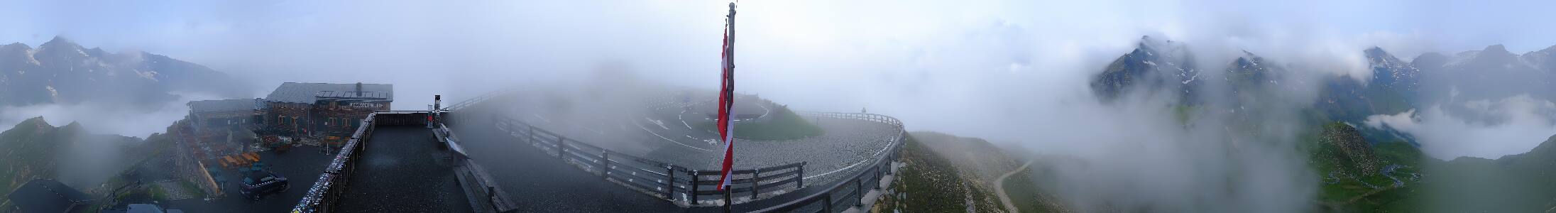
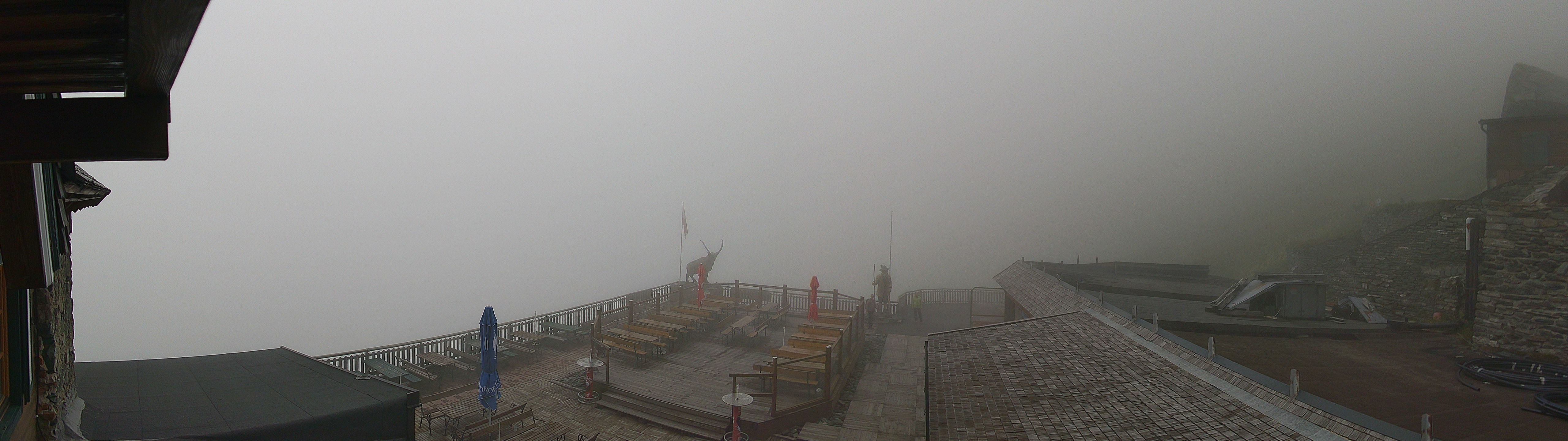
The first five camera cards are official Hohe Tauern / Foto-Webcam.eu views linked from the national park's webcam page: Freiwandeck, Feldkopf, Goldbergkees, Sonnblickbasis, and Kleinfleisskees. These are the best park-specific views for checking glacier, snow, cloud, and visibility conditions.

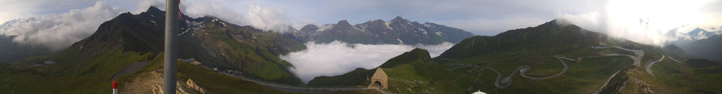
The Grossglockner High Alpine Road cameras are nearby park-region views rather than national park cameras. They are included because they show important Grossglockner access and weather conditions near one of the park's most visited areas.

Grossglockner and Krimml Waterfalls

Grossglockner and the Pasterze glacier are signature Hohe Tauern sights. The Grossglockner High Alpine Road webcam and weather page provides additional road and panorama views, while the Krimml Waterfalls page is useful for planning one of the region's most famous waterfall walks.

Planning Notes

High-alpine weather can change quickly in Hohe Tauern. Check official webcam pages, weather, trail information, road status, hut logistics, and season dates before heading into glacier terrain or onto the Grossglockner High Alpine Road. Snow and closures can affect travel well outside winter.

Planning answers

Frequently Asked Questions

Are the Hohe Tauern National Park webcams live?

The Hohe Tauern National Park webcam cards use live, current, or regularly refreshed camera sources when available. Some views may update as still images rather than continuous video.

Which Hohe Tauern National Park webcam should I check first?

Start with Freiwandeck - Grossglockner and Pasterze Webcam, Feldkopf - Wangenitztal Webcam, and Goldbergkees Webcam. These are the first active camera sources listed on this page and are useful for checking current views or nearby travel conditions.

Why might a Hohe Tauern National Park webcam be unavailable?

Park webcams can go offline because of weather, seasonal closures, maintenance, power issues, network outages, or camera provider changes.

Where can I confirm official Hohe Tauern National Park conditions?

Use this page as a quick webcam and planning hub, then confirm closures, alerts, road status, permits, and current conditions with the official Hohe Tauern National Park website.